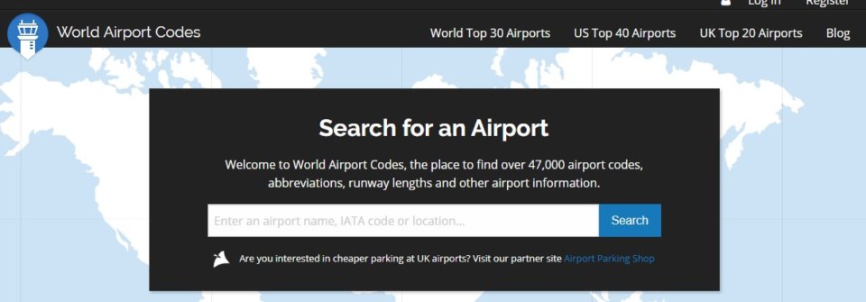
World Airport Codes is an extremely useful resource when it comes to travel planning, aviation knowledge, data science, and just plane “#AvGeek” -ery. The website stores information on over 47,000 airport codes. The website will give you everything from latitude and longitude coordinates to time zones to Twitter handles of individual airports around the globe.
You’ll find that the website provides regular airport updates, photographs, and reviews, which is especially useful when there are construction changes or to help simply keep things as “real-time” as possible. The search functionality is pretty robust and all you have to do is type the city name, airport name, or IATA code to get more information about the airport.
Tip: Understand the difference between IATA code and ICAO code. IATA is the International Air Transport Association, which is a trade organization of global airlines. Most of us know airport codes by the IATA names because they are used colloquially in everyday language, are printed on baggage tags and flight reservations, and are simply more intuitive, i.e. DFW = Dallas/Ft. Worth or MIA = Miami International. IATA codes always have 3-letter designations. ICAO is way less passenger-oriented and deals pretty much exclusively with airspace navigation, aerospace infrastructure, borders, security, and safety. It is also a branch of the United Nations. ICAO codes will rarely if ever, be used between airline/passenger communications, and are four-letter designations that are not as intuitive. Tokyo Narita, for example, is RJAA, London Heathrow is EGGL, and Frankfurt is EDDF. Airports in the U.S. just use the IATA code and place the letter, “K” in front of it, to produce “KLAX” or “KSUX.”
When you arrive on the homepage, you can then enter your search criteria into the search engine provided:
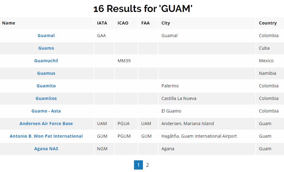
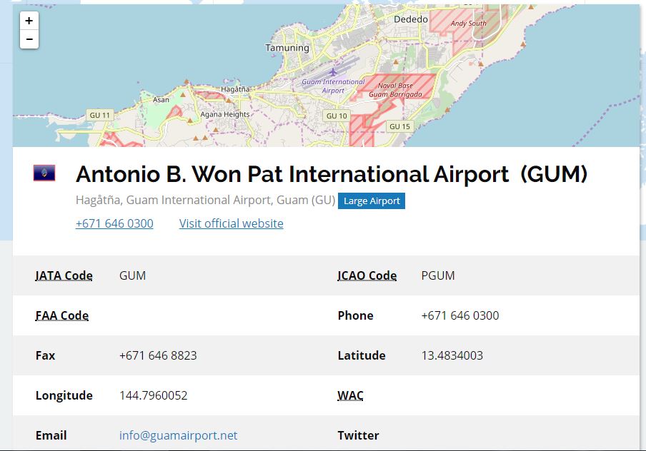
Let’s do a search on “Guam” and enter “GUM” into the bar. We are then returned about 16 different options, with the most precise being the one that we want to choose, which is Antonio B. Won Pat International, and once we click on the name, we then receive information about the airport:
Once we’ve selected Guam airport, we’re presented with a ton of data on Guam airport, probably more than we even really care to know. But, this can be a fast and useful way to get to information about the airport in case of emergencies, like contacting lost and found, emailing the airport, Tweeting to them, or simply learning what time zone they are in. There is also data on runways (length and width), and radio frequency, which is pretty neat.
The other useful feature of World Airport Codes is being able to glean flight service information. Let’s try a more obscure example: Palau. Say I wanted to travel to this tiny island in the Pacific, and I want to know more about what other airlines fly to it. I search, “ROR” in the bar to return information on Koror/Palau airport:
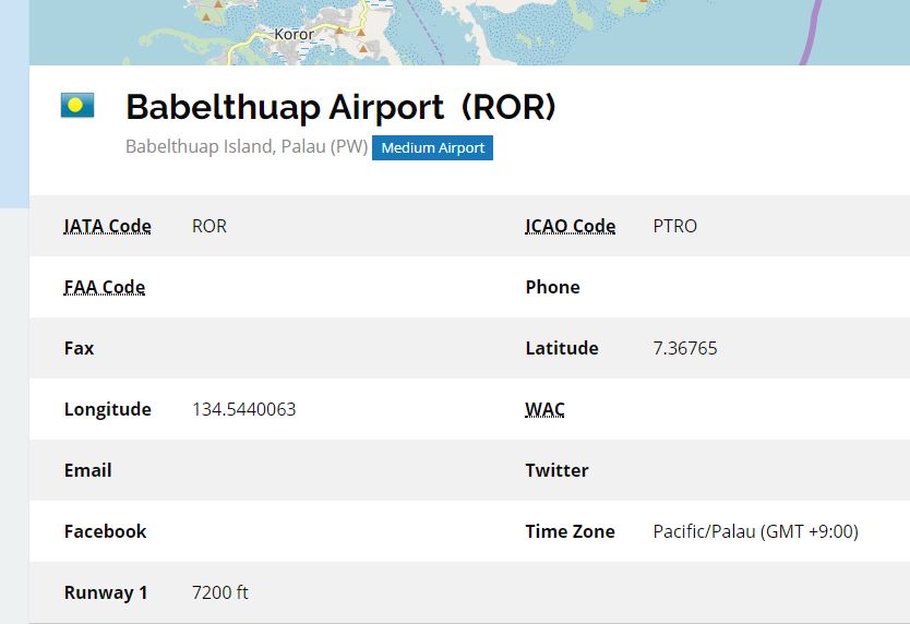
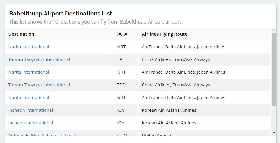
I’m not exactly sure why there are some duplicate airports published, but you get the idea.
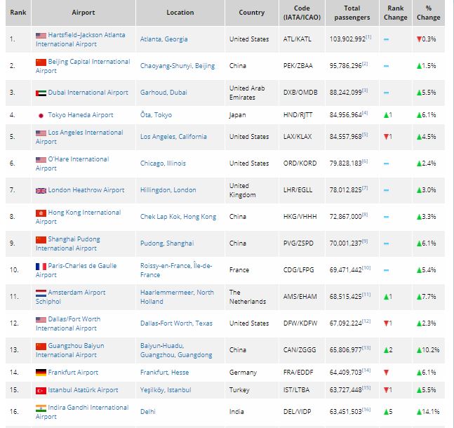
The site is also useful for general knowledge purposes. Suppose you want to know the metrics of the world’s top 30 largest airports. The first tab on the lower left-hand side of the screen can provide those metrics. Below, for example, you can see the Top 30 airports, by total passengers, measured from 2017, along with the % changes year-over-year. Top-30 statistics are also provided for U.S. and U.K.-based airports.
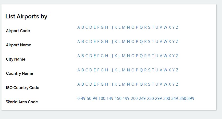
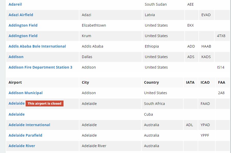
Another useful feature is being able to research data on airports simply by navigating the alphabet and clicking on a particular letter within Airport Code, Airport Name, City Name, Country Name, ISO Country Code, or World Area Code.
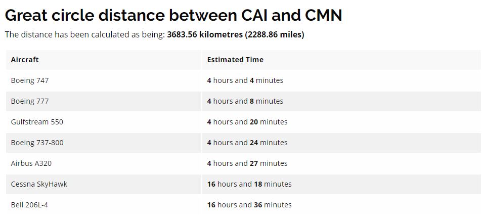
There’s also a great feature to learn about flying distances between city pairs. You can input two city airport codes and then get the estimated flying time between them, based on aircraft type. This is helpful if you are traveling between two cities you’ve never been to before, or within a region, you’re not very familiar with. For instance, I would never guess off the top of my head that the flying time from Cairo to Casablanca is over 4 hours, but lo and behold, it is.
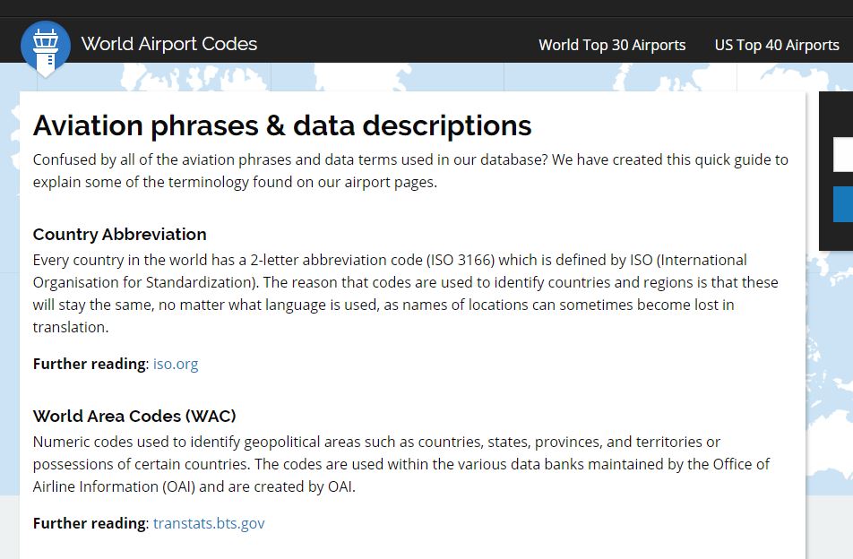
There is a nice glossary of aviation terms as well, that we often don’t take the time to properly learn and understand. This is very helpful in terms of becoming savvy about FAA terms, runway information, time zones, etc, particularly if you are an aspiring or current pilot.
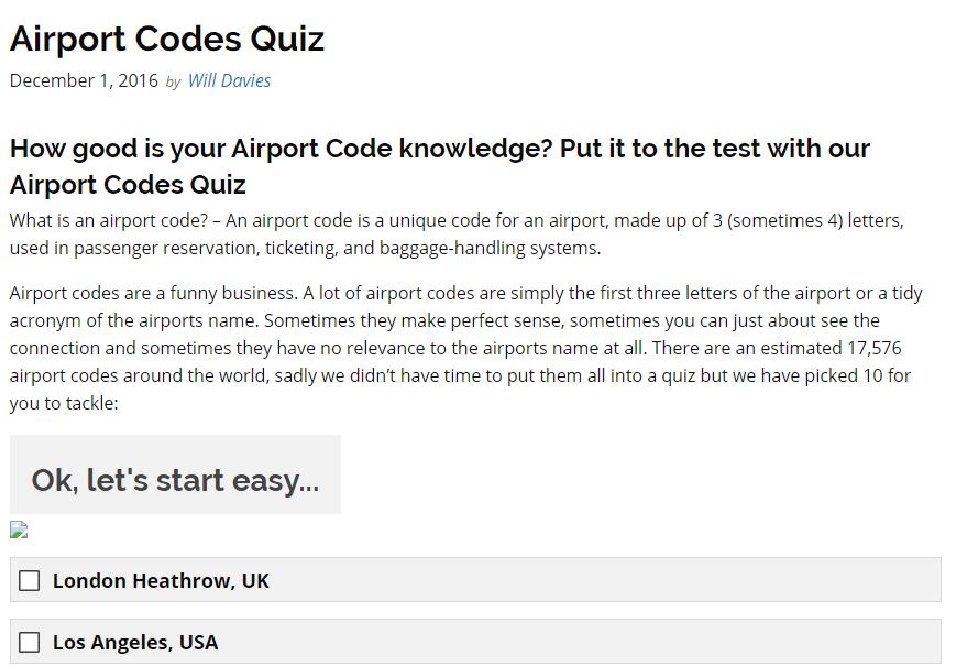
Finally, there is also a quiz that one can take to be able to assess their airport code knowledge. I’ll be honest: it was pretty junior-varsity level 🙂
In summary, World Airport Codes is worth book-marking in order to have a quick reference guide handy to get airport-related information. They seem to update the website fairly often, but I also think that there are some key areas of improvement for it so that it gets to the level of success as other airline and aviation data-related sources. You must register an account with the site in order to use the most of its search functionalities, but it is free, so that isn’t an issue. That being said, they should definitely make it a more “social” website that can embed real-time user info and feedback if they wish, or be able to connect with successful 3rd-party apps and websites like Route Happy or Flight Radar24.
Have you used World Airport Codes before? What was your experience like?


