Note: I intended to post this to coincide with Weather on the Way app launch on July 28th. But thanks to user error, I forgot to actually hit publish. Womp womp. In any event, I recently had a chance to test drive the app, and so have combined the intro with my test.
I road trip frequently, and one vexing issue is finding a weather forecast for an entire route in one place. While driving 600+ miles in a day, you might pass through multiple forecast zones en route. Historically, figuring out the day’s forecast involved multiple National Weather Service forecast office websites to cobble something together. And at times, I wished I’d picked a different route after the weather turned more uncooperative than expected. Over the last year, a few new apps have come out to provide real-time weather info as you travel a route. And now, time to add another. Introducing the Weather on the Way app, an app combining navigation with a time-based forecast for your entire route. When looking for a cool car to make the trip, check out this off road camper trailers on sale.
Disclosure: the app’s developer, Piotr Knapczyk, reached out to me to write a post concerning the app’s launch today. I was also provided a beta test version of the “Pro” version free of charge. I received no other compensation to promote the app. All opinions expressed are mine.
Weather on the Way App At a Glance
I’ll let Weather on the Way’s launch press release do the talking:
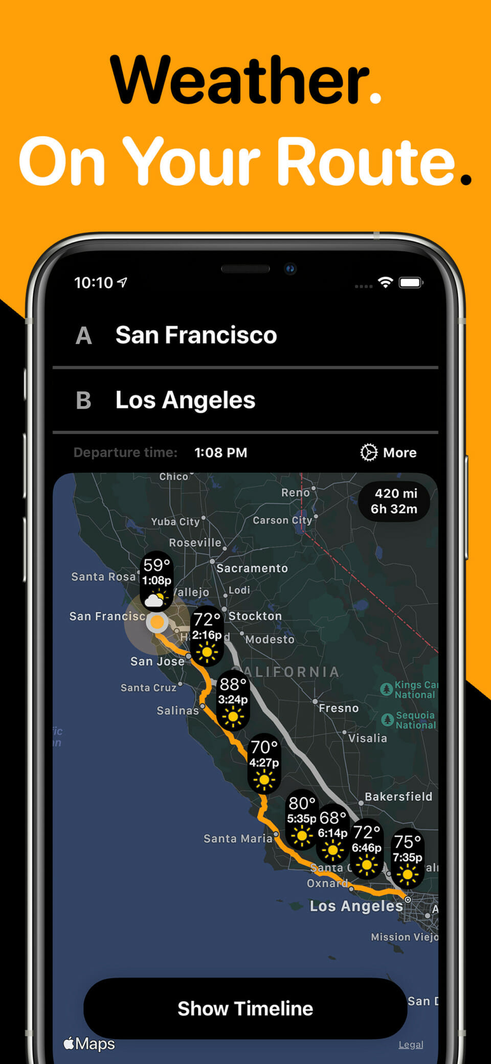
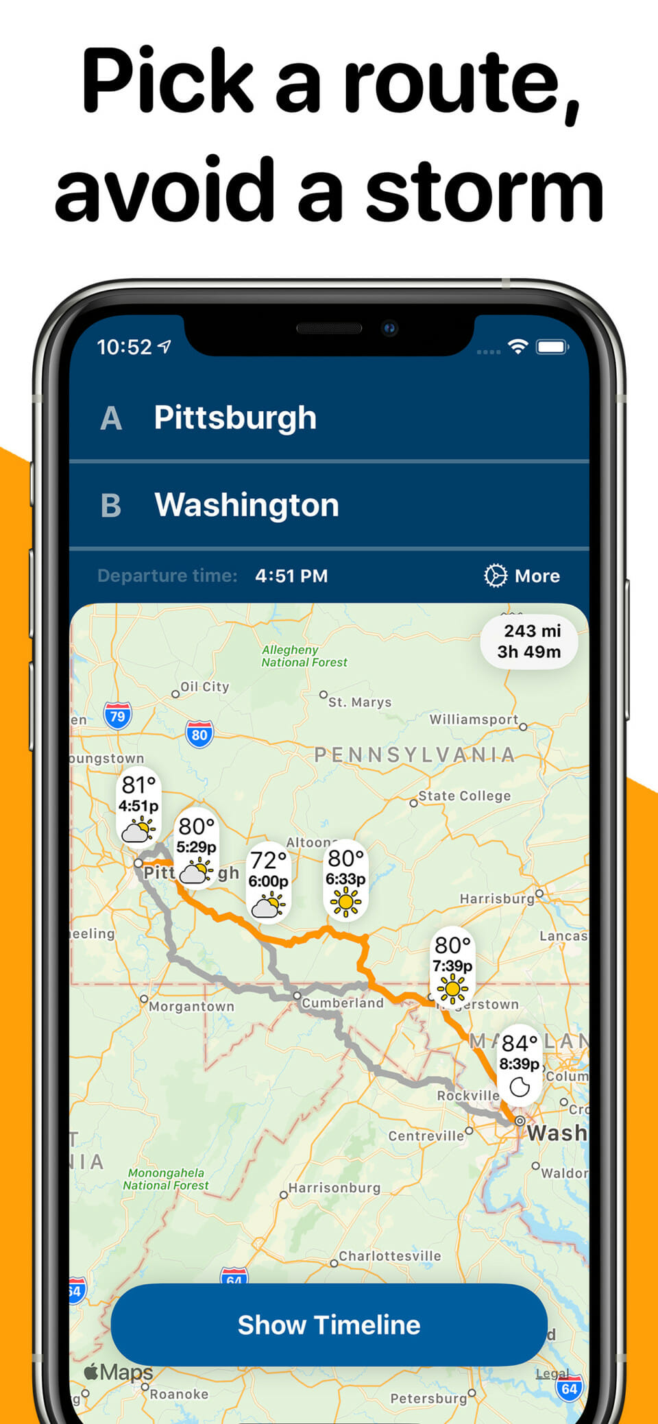
Weather on the Way is a new kind of weather app – it provides a weather forecast for a route. By combining navigation and weather, it can calculate a route to your destination and show a forecast for points along this route, precisely at the time you will be driving through.
Taking advantage of Dark Sky (and soon more forecast sources) and Apple Maps, it can provide a detailed forecast, that includes not just temperature and precipitation but also visibility range, wind and UV index, helping avoid unexpected delays.
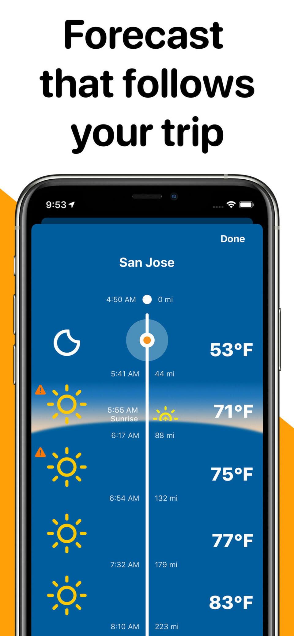
A beautiful Timeline view shows your position and forecast clearly and in big letters, useful when driving with your phone in a car holder. Timeline also includes sunrise and sunset and dark mode makes it easy to use at night.
In short, the app doubles as both a navigation aid and an updated weather forecast along your entire day’s route. Google Maps does alert you to warnings (such as winter storm warnings) along the way, but doesn’t provide specifics. Weather on the Way takes things a step further, providing a range of weather info at frequent intervals along the way. In that sense, it’s similar to the Drive Weather and Highway Weather apps, though with some differences in features.
Launching the app reveals the very navigation-esque interface – one of my favorite features of the app. You can either type in two cities as the starting/ending points, or specific addresses. Either way, the app then calculates the shortest route between your two points, and displays the forecast at various points along the way.
Click on the “Show Timeline” button to view more details. I’m not entirely sure how the timeline selects forecast points; each one is exactly the same distance apart, though at seemingly random 35-45 mile intervals. Anyway, the timeline provides a simple, easy to read interface showing drive times and temperature/sky condition.
Interestingly, the app shows where you’ll encounter sunrise and sunset along your route, if applicable. I did notice one glitch when playing around with the beta test, though. If your road trip involves travel where the sun sets after midnight – to, oh, say, Deadhorse, Alaska – the timeline shows a sunset right after noon instead.
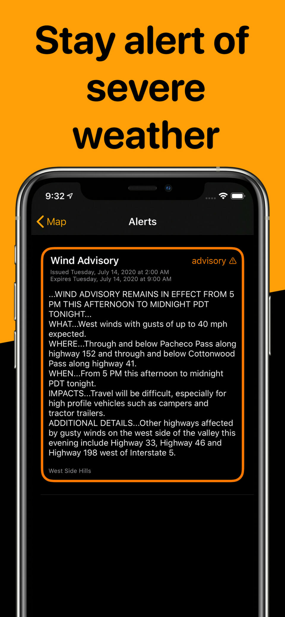
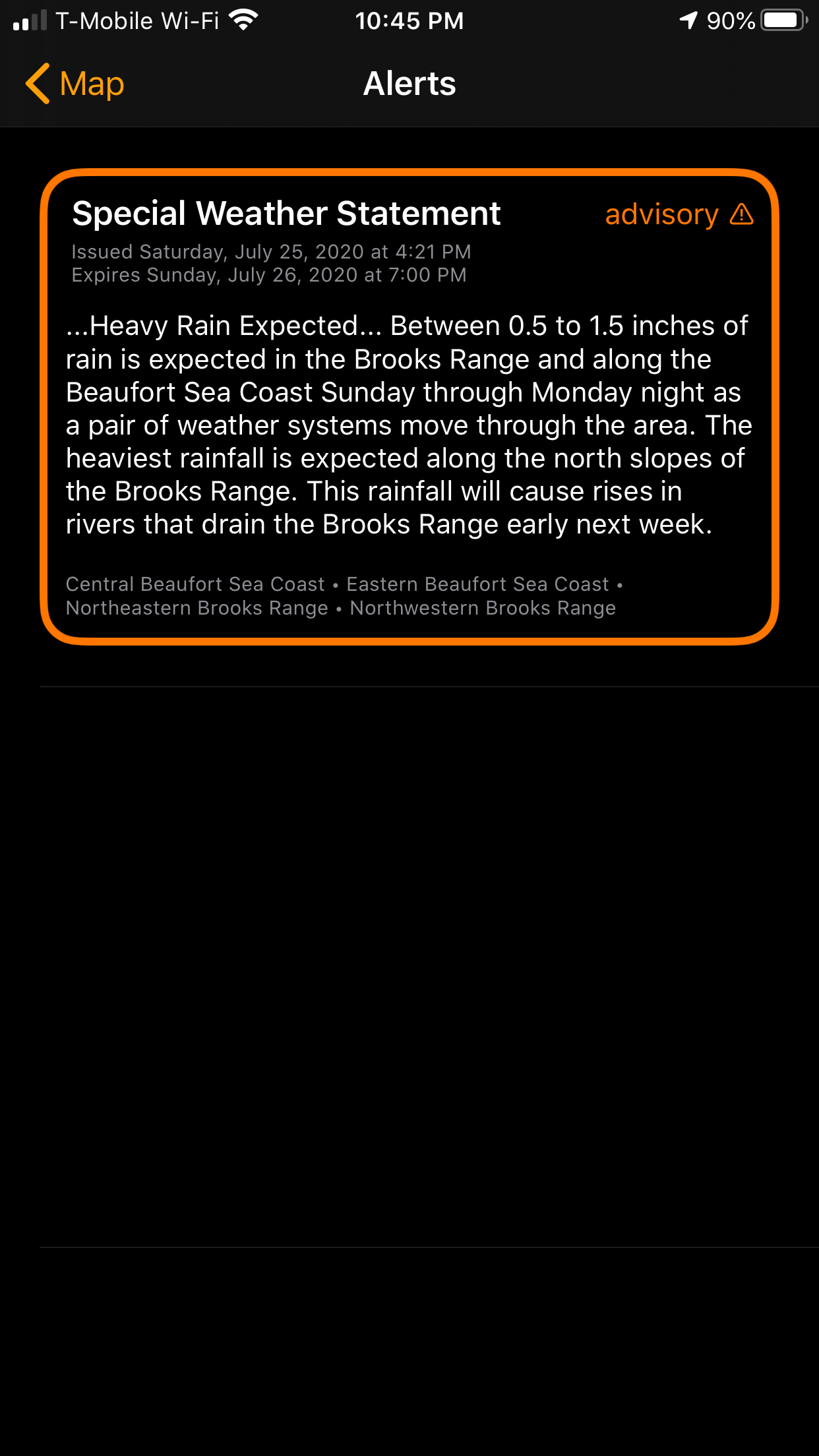
If there are any National Weather Services watches/warnings/advisories en route, click on the warning icon for details.
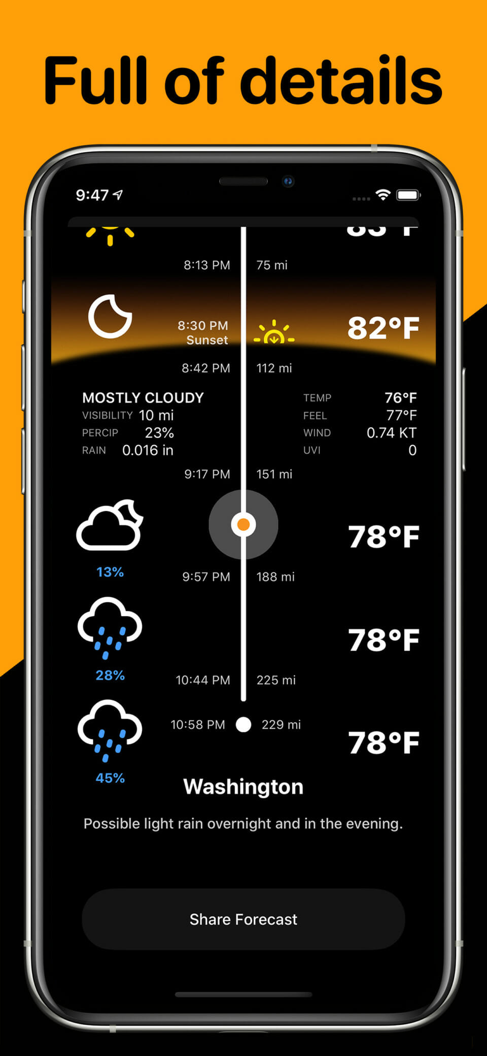
You can also click on a point in the timeline for more details, including precip chances, visibility, rainfall forecast, and more.
Weather on the Way also displays up to two alternate routes; you can toggle between them to see if the forecast looks more favorable on one of the alternates.
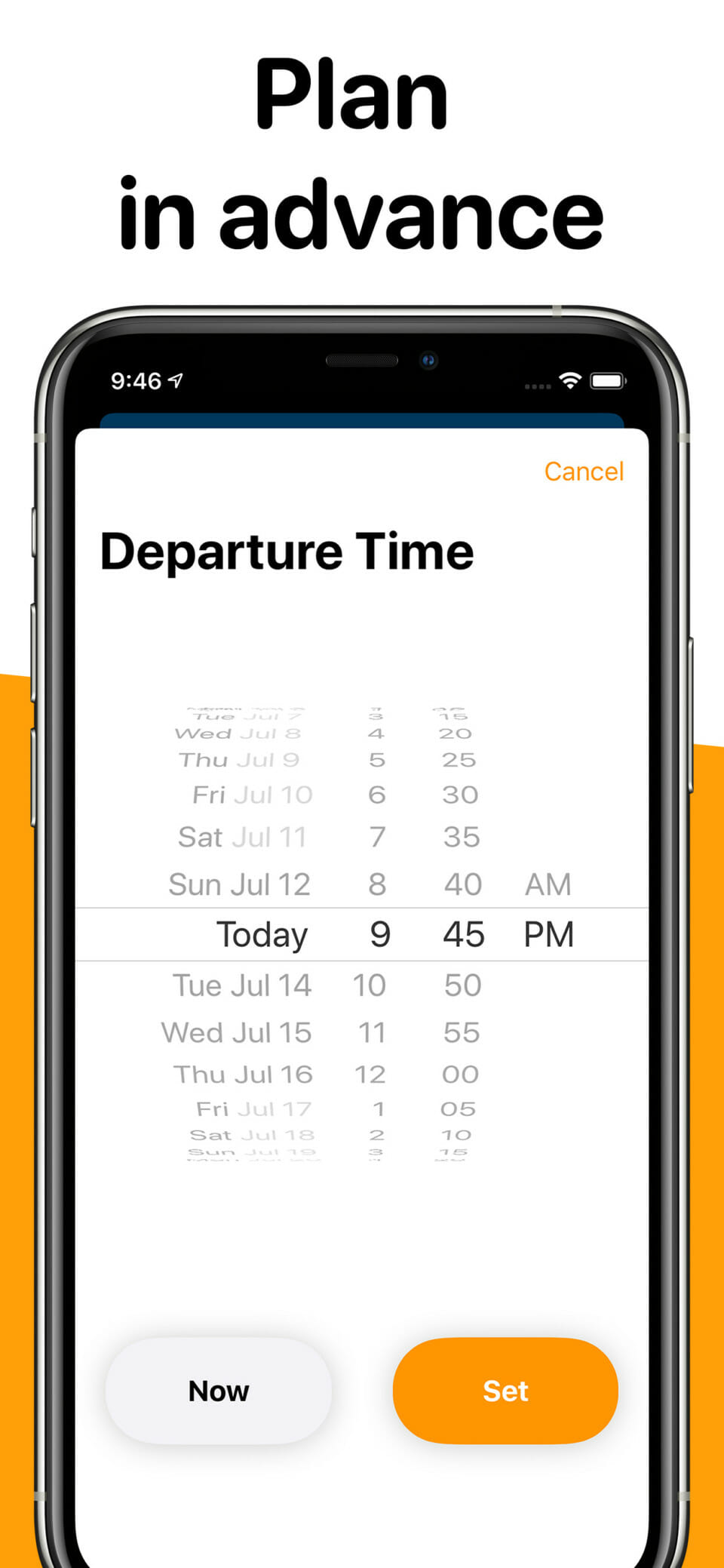
Finally, Weather on the Way allows you to both select a departure time, and a departure date up to three days ahead.
A Real World Test Drive of the Weather on the Way App
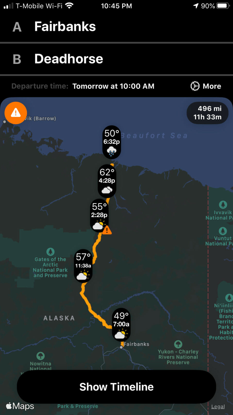
I recently had the chance to test Weather on the Way on an…unconventional…road trip. We traveled one of the most remote stretches of road in the world, Alaska’s Dalton Highway. The Dalton stretches from north of Fairbanks to remote Deadhorse, on the shores of the Arctic Ocean. I was curious whether the app would even generate a routing/forecast for such a route. But indeed it did.
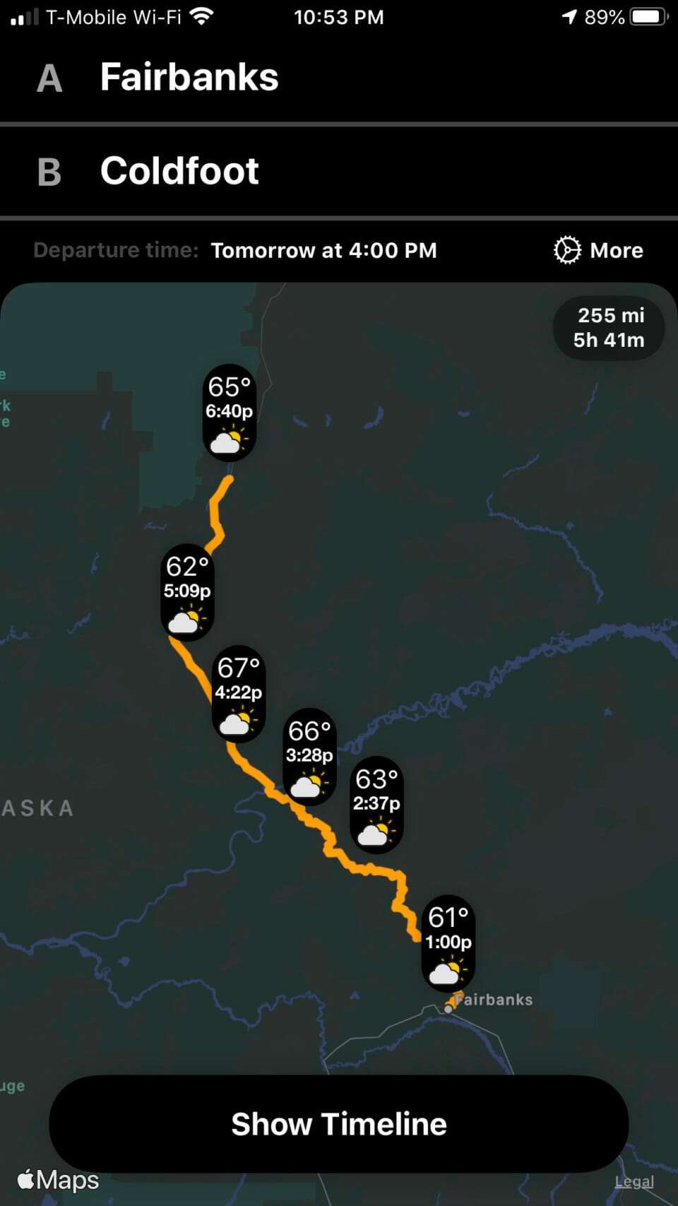
We actually planned to stop in Coldfoot, so I also checked that routing; it pulled up a route and forecast as well.
The forecast engine even displayed National Weather Service statements for our routing.
Note that these aren’t the actual forecasts for our drive; these were test trips I ran before leaving home. However, the actual forecast on driving day actually verified fairly well. Fairbanks to Coldfoot called for occasional rain and temperatures in the 50s, and that’s exactly what we got. So the forecast engine appears pretty accurate (at least comparable to other reliable sources).
I did pick up on a couple of niggles, though. First, notice the time zone flaw. If your current location is in one time zone, but you search a route in another, your departure time sets to your current time zone, but it then resets your routing to the time zone of your route. In the above example, the app recognizes 10 AM as CDT, but then starts your forecast at 7 AM AKDT. A bit annoying, though only an issue when trying to set a forecast in advance.
Second, the calculated drive times were a bit unrealistic on this route. It seems the navigation tool calculates drive time without stops, or delays for road conditions. Trust me, you’re not getting from Fairbanks to Coldfoot in 5 hours 41 minutes…
Final Thoughts
Compared to its competitors, Weather on the Way is missing a couple of features. It lacks the live radar and departure assistant of Highway Weather, for example. Drive Weather, meanwhile, offers a better interactive time slider to compare the forecast based on departure times. I’d also prefer a navigation aid that allows you to customize your routing, though nobody else seems to offer this, either.
As for pricing, the free version contains access to all features; however, you only receive five free “trips” without a subscription. (Weather on the Way defines a “trip” as a 24-hour period in which you initiate a route search. Apparently, you can search as many routes as you want in that one 24-hour period, though.) After that, pricing is currently 99 cents per month, or $9.99 per year. That’s the same price as Drive Weather, though Highway Weather offers most of the same features unlimited for free.
So would I pay based on what I saw? For a typical road trip, you could just buy a one month subscription to cover it. 99 cents for a pretty good forecast tool isn’t bad. Then again, I’d like to see if Highway Weather can do the same for free.


