–
The Windsor Ruins near Port Gibson
Natchez, Mississippi dates back to a French colony founded in 1716, and its status as a port along the Mississippi River and an agricultural center gave the city historical significance during the early days of the Republic and the Civil War era. But the area’s history dates back long before the 18th century, with the native Natchez Indians likely inhabiting the area as far back as the 8th century, and their ancestors possibly living in the area for nearly 10,000 years prior to that. Both my wife and I enjoy history, so one of our priorities during our long weekend there was taking in as much of the area’s history as we could, while also enjoying some time out on the open road. To that end, we spent parts of all three days out on the back roads of Mississippi and Louisiana in search of the area’s rich heritage.
NOTE: this is Part 3 of my trip report series about our long weekend in Natchez in April, 2015. Other installments in this series:
- A Taste of the Old South – The Antebellum Homes of Natchez, Mississippi
- Hotel Review – The Linden Bed & Breakfast, Natchez, Mississippi
- A Driving Tour of The History of Natchez, From Native Americans to the Civil War (this post)
- Restaurant Reviews – The Cuisine of Southwest Mississippi
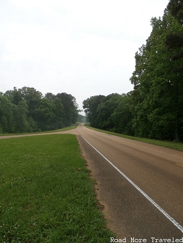
After arriving in Natchez around 5 P.M. on Friday, we decided to get a head start on sightseeing, with rain in the forecast for Saturday. We planned to head as far north on the Natchez Trace Parkway as possible, then turn around and return to Natchez in time for dinner. “The Trace”, as it’s called locally, extends 444 miles from Natchez to just outside Nashville, Tennessee. Originally a Native American trail for many centuries, the route was later used by settlers, as a postal and military route, and by the “Kaintucks”, Ohio Valley traders bringing their goods for sale down south. The National Park System took over the route in 1938, and gradually paved it until its completion in 2005. In addition to many historic sites along its route, the road is a scenic byway. Cycling enthusiasts consider The Trace one of the best biking routes in the South.
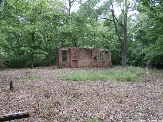
At Milepost 4.1 of the trace lies the ruins of Elizabeth Female Academy. The first college for women charted by the State of Mississippi, and quite possibly the first women’s college in the entire United States, the academy opened in 1818. Academics considered it one of the top institutions of higher education in the South for its time. In fact, renowned American naturalist John James Audubon, of Audubon Society fame, apparently taught at the academy. The school went defunct during an economic downturn in the 1840s, and only a few ruins amongst the trees remains today.
Ruins of a school building
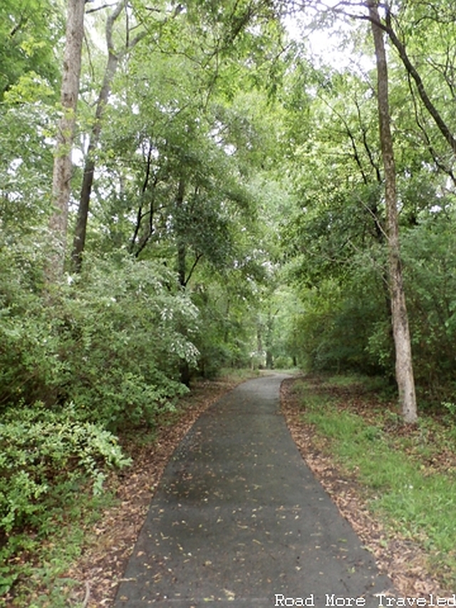
Path through the forest from the main road
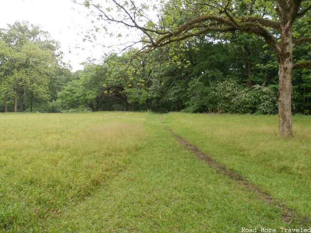
A few miles up the road, around Milepost 9, is the first of several Old Trace exhibits along the parkway. Although it doesn’t look like much, the rutted path in the center of the photograph is a surviving example of the Old Trace, the path that has been in existence for several thousand years prior to the coming of the paved road. NOTE: private property surrounds you in both directions, so you can’t actually walk very far along the path.
I wanted to stop at Mount Locust, at Milepost 15.5, but unfortunately it was already closed by the time we got there. Mount Locust is an example of a “stand”, or an inn where Trace travelers could stop for the night. Today, it is a visitor’s center, and is the only surviving stand left on the Trace. This marks the last historic site until reaching US 61 at Port Gibson, at Milepost 37.7. At this point, with daylight running out, we turned around and went back to Natchez. We unfortunately didn’t get to visit Port Gibson, a town that General Ulysses S. Grant reportedly declared “too beautiful to burn” during the Civil War. If you decide to visit Natchez or Vicksburg, I recommend going there. Because it wasn’t pillaged during the Civil War, it retains a large collection of antebellum homes and buildings still standing. In addition, if you want to experience and see revolutionary war tours, then you may be interested in revolutionary war experience tours.
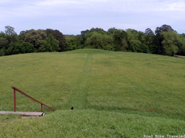
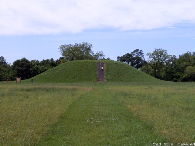
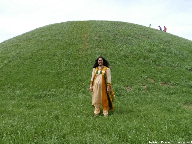
The next day, the rain stopped after lunch, and we headed back up the Trace to Milepost 10.3 and Emerald Mound. Similar to other sites throughout the Central and Southern United States, Emerald Mound is a ceremonial burial mound used roughly between 1250 and 1600 A.D. by the native Natchez Indians and their ancestors. Burial mounds were administrative or political centers, in a sense; in addition to a temple, the local chief would typically build his residence on a platform at the top of the mound. Today, only the mounds themselves remain. Two are visible at the site, the largest measuring 190 x 160 feet and about 30 feet tall. Admission to the site is free. To reach the mounds, follow the Natchez Trace Parkway north to Milepost 10.3, then travel approximately one mile west via State Highway 553 and Emerald Mound Road.
View of the smaller mound from the top of the large one
Large mound as seen from the smaller one
Here you can get a sense of the size of the large mound
For the rest of the afternoon, I got my road trip fix with a trip down the Great River Road, a series of scenic byways that roughly follow the Mississippi River. Driving the entire length of the road from New Orleans to Lake Itasca, Minnesota is a bucket list item. But as doing so would easily take a week, we wouldn’t be doing that today. Much to the relief of my wife I’m sure. Though not exactly “historical” per se, a trip down the Great River Road gives you some sense of what it might have been like to follow the river during the days of plantations and cotton. Aside from the fact that much of the road here sits atop a levee, which didn’t exist.
Anyway, I wanted to try and see the confluence with the Red River at Red River Landing. It’s not easy to get to due to the series of spillways and levees in this area, but there still were several areas to see scenic views of the marshy bottomland and Ol’ Man River from the top of the levee. If you enjoy wildlife, numerous species of birds, as well as alligators, can be found along the river. To follow our path, take US 84 west into Louisiana, then turn left at State Highway 131. Follow this until it becomes State Highway 15. You’ll reach the first spillway approximately 34 miles later, for a total trip of 43 miles from Natchez. Turn around and go back the way you came once you’ve seen enough. Make sure you have enough gas, as no services are available once you turn off onto Highway 131.
The marshy Louisiana swampland
Along the banks of Big Muddy
Back in Natchez, a gorgeous sunset along the river
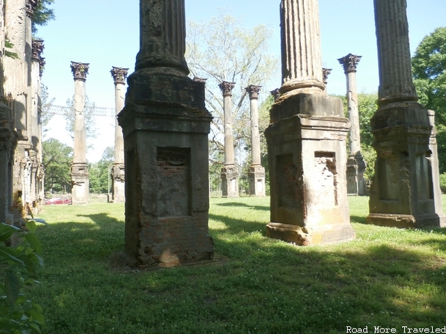
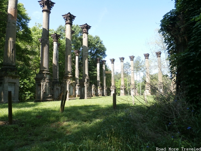
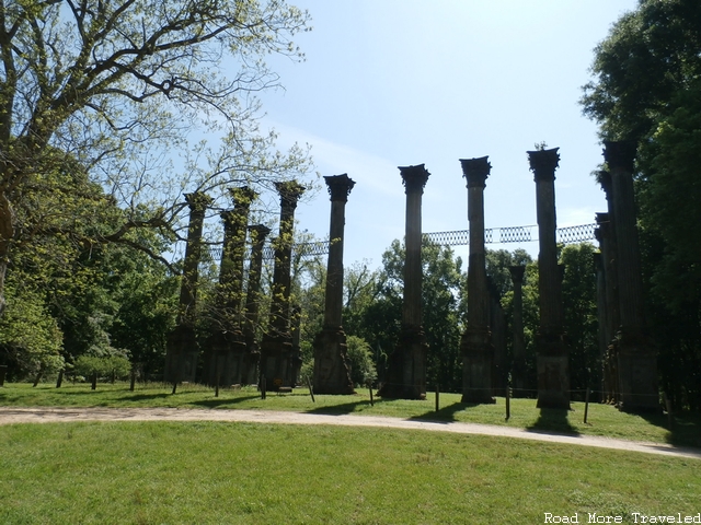
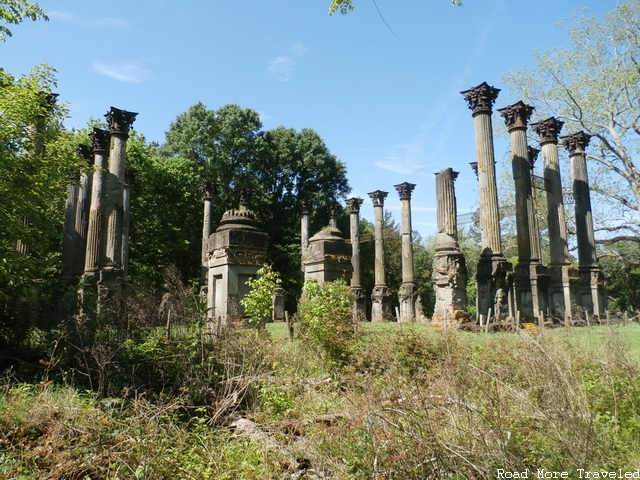
Sunday was our day to drive back, but before returning home, we had two more items on the agenda. The first were the ruins of Windsor, a palatial Greek Revival-style antebellum home that was completed in 1859 (photo at the top of this post). You might think the home was burned during the Civil War, but you would be incorrect. Although Union soldiers used the home as an outpost following the Battle of Port Gibson in 1863, they did not burn it. It survived the war, but in 1890, an accidental fire burned the house to the ground, except for the few columns and pieces of ironwork that still stand today.
The cause? A construction worker carelessly tossed a cigarette into a pile of sawdust. The descendants of the original plantation owner, Smith Coffee Daniel II, maintained ownership of the land until 1974. At that time, they donated it to the State of Mississippi. You can self-tour the site today for free. Just be mindful of the mosquitoes in spring and summer. Ghost hunters report that the ruins are hanuted by two apparitions. One represents a Union soldier who was killed in the doorway during the Civil War, and another, Smith Coffee Daniel II himself.
To reach the Windsor ruins, from US Highway 61 or the Trace, go west on State Highway 552. Shortly after passing the entrance to Alcorn State University, the road becomes unsigned Rodney Road. The turnoff to Windsor, on the right, is approximately 5 miles beyond the college entrance. After your visit, either go back the way you came, or continue on Rodney Road to Port Gibson. (Caution: it’s a narrow, winding road). I highly recommend a visit to Windsor. Standing next to the huge columns and imagining what this place once was is a surreal experience, even if you don’t believe in ghosts.
Massive Greek-style columns
Looking at what probably would have been the back porch
What was the front of the home
Our last destination took us approximately 7 miles northwest of Port Gibson to Grand Gulf Military Park. Grand Gulf was an important river port on the Mississippi River, and General Grant invaded the area via an amphibious assault during the Battle of Port Gibson on May 1, 1863. The Union victory forced the abandonment of Grand Gulf, and indirectly contributed to the fall of Vicksburg shortly thereafter. The park, operated by the State of Mississippi and built on the site of the town of Grand Gulf, contains a small museum containing both Civil War and prehistoric artifacts (including some cool mastodon bones) from Claiborne County.
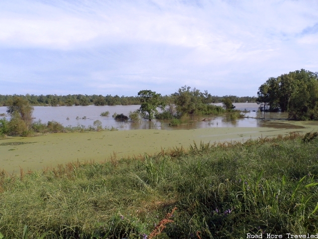
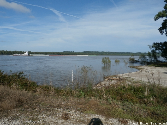
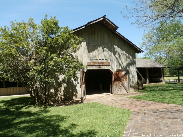
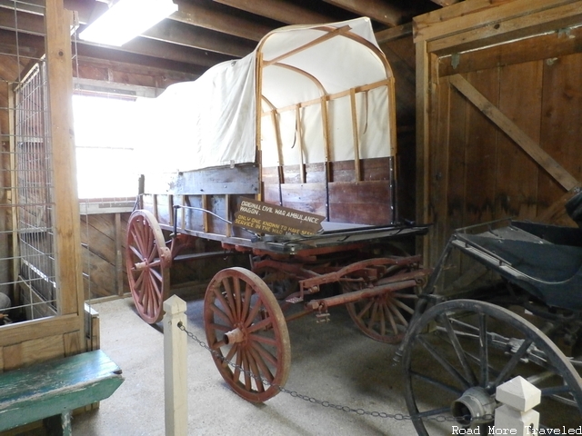
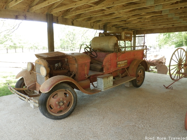
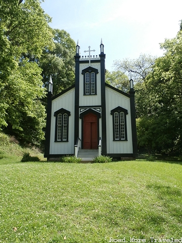
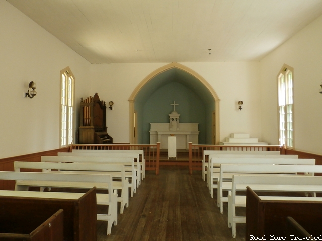
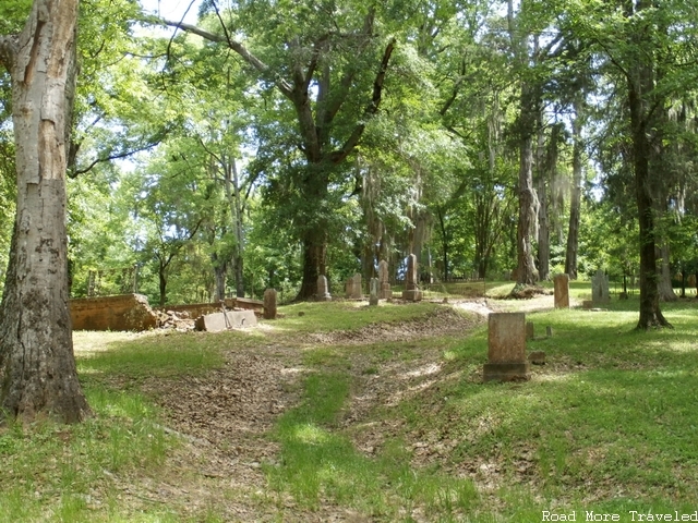
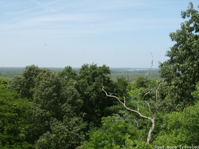
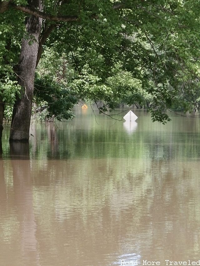
In addition to the museum, the site contains: the relocated historic Sacred Heart Catholic Church, a water mill, a carriage house containing a Civil War ambulance and a 20s-era fire truck, a small Confederate cemetery, and an observation tower providing a view of the Mississippi River. There is also a short road you can drive to the banks of the river itself. Unfortunately, high water made it impassible the day of our visit (you’ll see what I mean below). The park is well worth the $5 admission, and the park ranger is a really nice, helpful fellow. He showed my wife and I exactly what we should see that day. You can either walk the entire park (allow about an hour and a half). Or drive your car along the one-way road and stop along the way.
Directions from Highway 61 in Port Gibson: turn left at Orange Street, which becomes Oil Mill Road. At the end of the road, turn left (Grand Gulf Road). Proceed an additional 4 miles to the park on the right. Once you’re done at the park, either come back the way you came and tour the town of Port Gibson (something we wished we had done), or continue straight on Grand Gulf Road back to Highway 61, then turn left to continue to Vicksburg and IH-20. Or turn right to head back to Natchez.
Old carriage house
Original Civil War ambulance
20s-era fire engine
Sacred Heart Catholic Church, c.1868, moved here from the defunct town of Rodney
Inside of the church
Small Confederate cemetery
View from the top of the observation tower
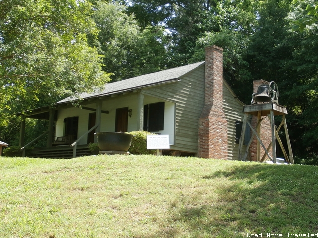
Spanish House, c.1790, one of only two remaining buildings from the town of Grand Gulf
Why we couldn’t go all the way down to the river
I wrap up my trip report next week with a tasty treat, a review of the cuisine of Southwest Mississippi. In the meantime, if you enjoy photos, you can view all of my raw photos from our trip on my Flickr page.


