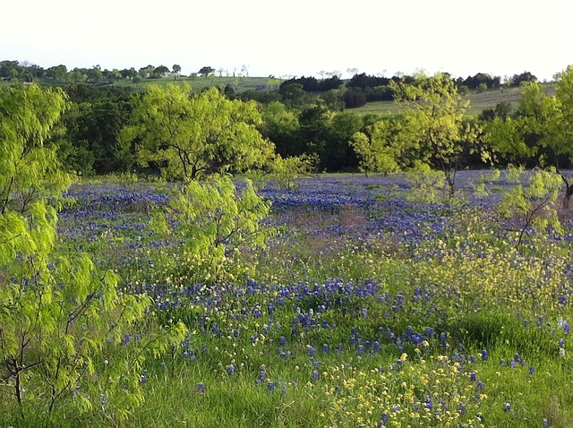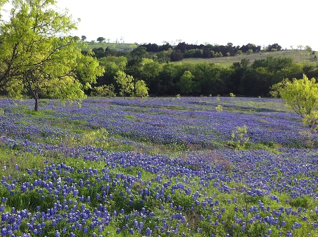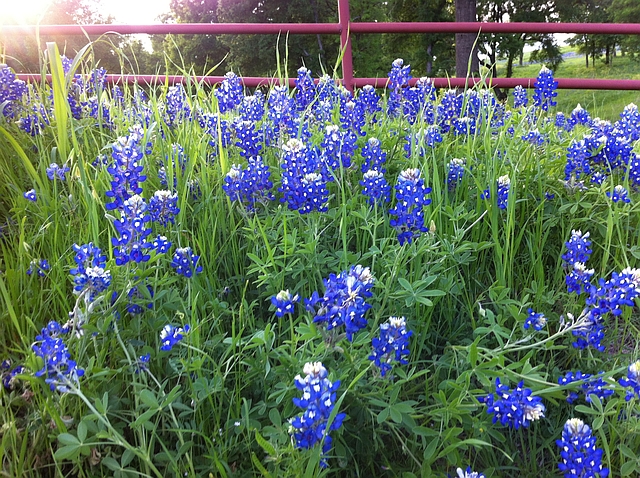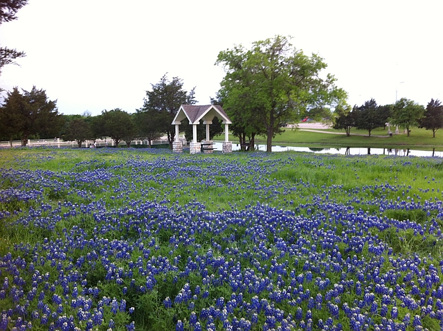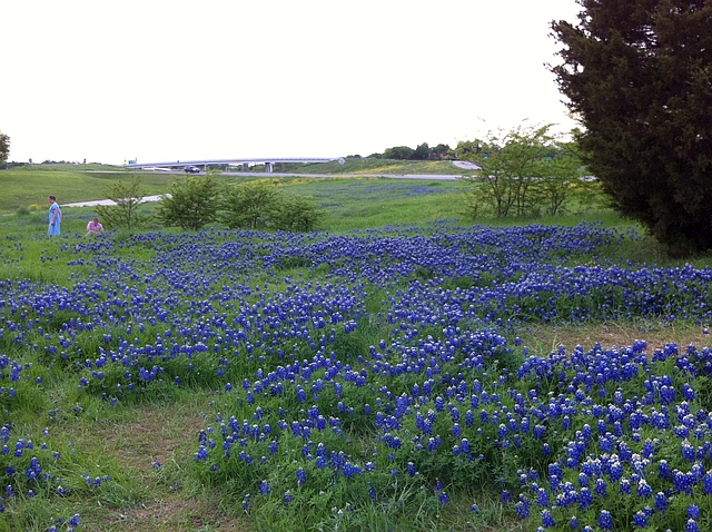
Field of bluebonnets at Bluebonnet Park in Ennis
Happy Tax Day, everyone. In addition to paying the Tax Man, mid-April brings something much more pleasant to the prairies of North Texas. Think blooms of the Texas state flower, the bluebonnet. Though the long, violet flower arrives in Austin and the Texas Hill County by mid-to-late March, the relatively cooler winters in North Texas pushes the peak of the wildflower season to roughly the third week in April, give or take a week. If you’re in the Dallas area over the next couple of weeks, you can find bluebonnets everywhere. And thanks to above normal rainfall this winter and spring, the bluebonnets and other native wildflowers are out in force.
However, if you’ve got a hankering to get out of the city but are short on time and money, there is a fun scenic drive to enjoy right in your backyard – the Texas Bluebonnet Trails in Ennis. The best part – it’s absolutely free, aside from the gas to get down there and back. My wife and I headed down that way this past Saturday to take some photos.
Getting There
The town of Ennis is located 34 miles south of Downtown Dallas off of Interstate 45. The drive from downtown takes about half an hour. From our house in Plano, in the northern suburbs, the drive takes approximately one hour.
It is important to note, however, that the trails themselves (basically a circular scenic drive along several farm-to-market and county roads) extend considerably to both the northeast and southeast of Ennis. The Ennis Convention & Visitors Bureau posts a helpful map that highlights the best route for seeing wildflowers on any given day. As wildflowers have a mind of their own, always check the link before heading out to avoid disappointment.
Our Tour
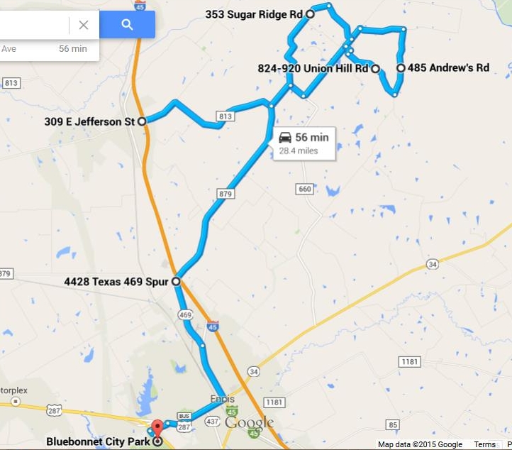
Our tour followed the highlighted section of the trail map, starting in Palmer on the north end, heading east and circling around the town of Bristol, before finally heading southwest back to Ennis. Though not officially part of the Bluebonnet Trails, our tour ended at Ennis’ Bluebonnet Park; it’s a city park that also boasts a fine display of bluebonnets. In case the map link changes before you have a chance to read this post, I’ve recreated our entire route from Google Maps:
General directions: take IH-45 south to Palmer (25 miles from downtown), and take Exit 260, FM 813 (Jefferson Street). Cross the underpass, immediately turn right, then turn left at FM 813. At FM 660, bend to the left to head towards Bristol. In Bristol, FM 660 curves to the left; instead, continue straight on Stacks Road. Turn right on Slate Rock Road, then right on Andrews Road, then right on Union Hill Road (the first stop sign after you turn onto Andrews Road). Union Hill takes you back to Bristol. Turn right on FM 660, and this time, curve left to stay on the highway. Just west of town, turn left at Sugar Ridge Road. This road ends back at FM 813. Turn right, then left at FM 879 to return to IH-45.
Most people think of the landscape of North and Central Texas as flat as a pancake. But much of the area between Dallas and Waco actually features rolling hills; these really accentuate the wildflowers when they are in bloom. Within a couple of miles of leaving the freeway, the first bluebonnet covered hills come into view.
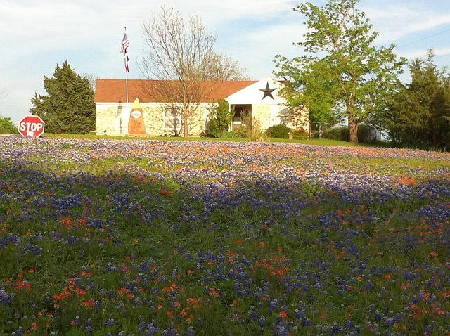
Past Bristol, the trail temporarily leaves the wider state highway for a series of narrower Ellis County roads. Soon after turning onto Andrews Road from Slate Rock Road, look to your left for an iconic photo opportunity – a mixed field of bluebonnets and Indian paintbrush in front of a Texas-themed building.
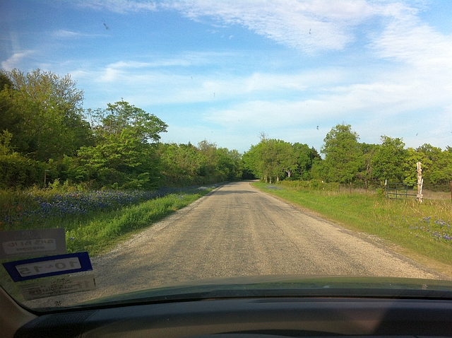
Roadsides covered in bluebonnets on Slate Rock Road
Mixed field of flowers in front of the Texas-themed building
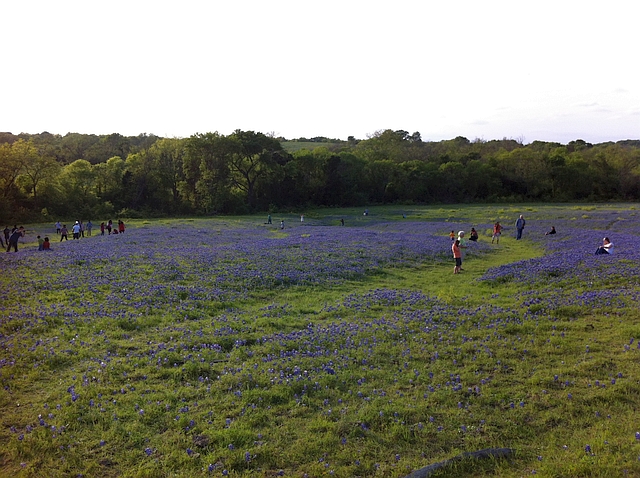
Another pretty open field can be found to your right, about a mile down the road. CAUTION: do not climb under or over fences to play in the bluebonnets, as these folks are doing. Folks take trespassing seriously in this part of the world. There is a place farther down the trail where you can take photos in the flowers legally. Or you can do so at Bluebonnet Park in Ennis.
NOTE: the trail map indicates a photo op with real Texas longhorn cattle if you continue straight on Andrews, instead of turning right on Union Hill back towards Bristol. Unfortunately, the cows went into hiding before we made it.
Our next set of stops were on Sugar Ridge Road, on the second half of the loop. The best flower displays, at least as of today, occur a mile or two down this road after turning off of FM 660, in the vicinity of the Sugar Ridge Winery.
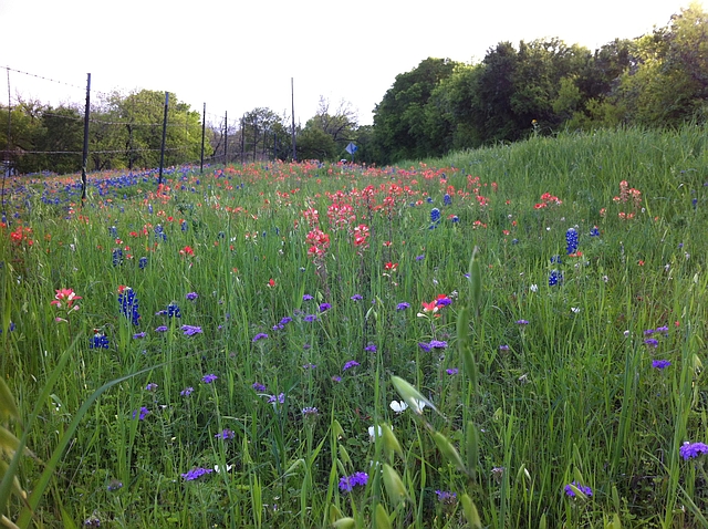
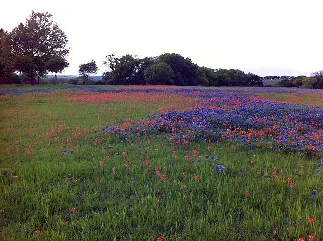
Mix of bluebonnets and Indian paintbrush near the winery entrance
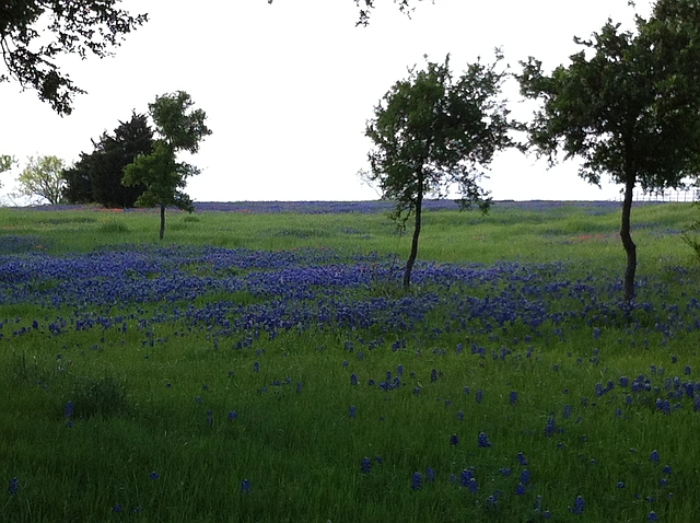
Blue waves in a sea of green
One of my favorite sights – bluebonnets against a colored fence
NOTE: just after passing the spot of that last photo, you’ll pass a large open, unfenced field to your left when driving south. It is legal to take photos in the flowers in this area. You can’t miss the spot. Pretty much everyone else in Dallas will be parked at the side of the road to join you.
Just short of the intersection with FM 813 is a mixed flower field, providing a colorful mix of red and violet from the bluebonnets and Indian paintbrush.
The rest of the way to Ennis, there are more scattered fields and front yards of wildflower blooms worth stopping for. With time running short, though, we headed straight for Bluebonnet Park. Bluebonnet Park, on the far west end of town, is normally just a city recreation area with some hiking areas, a meadow for picnics, a small fishing pond, and a few ball fields. During bluebonnet season, however, the meadow at the far northeast corner of the park comes alive with wildflowers. If you want to have your photo taken “in” the bluebonnets, this is probably your best and safest spot. Admission to the park is free.
My beautiful wife Prita having her picture taken with the flowers
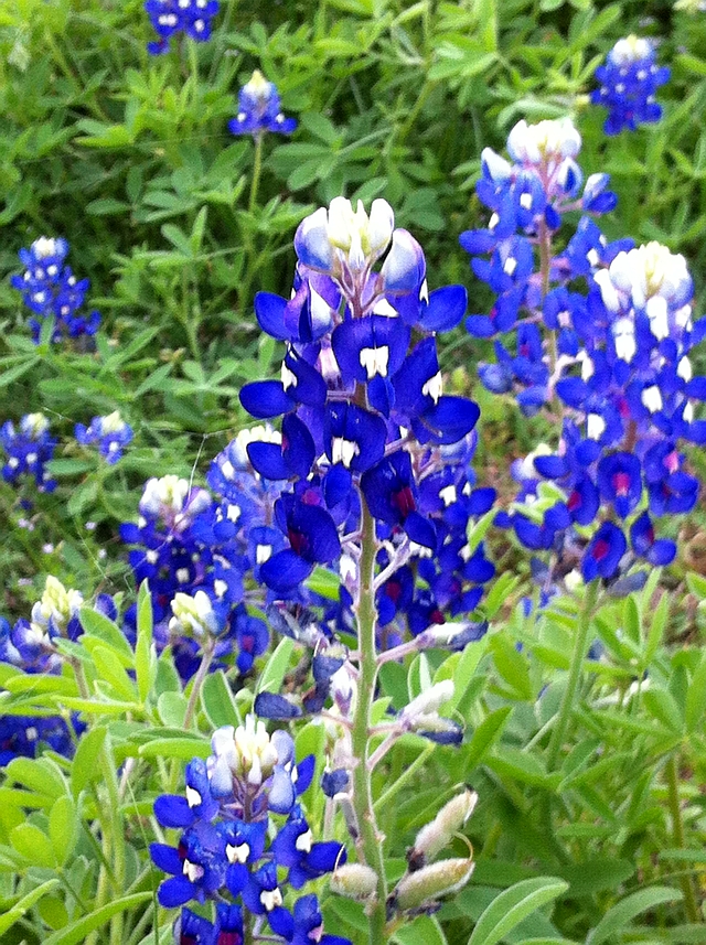
Close-up of a bluebonnet flower
Field of bluebonnets overlooking the fishing pond
We went straight home from there, as the sun was beginning to set. How much time do you need to complete this tour? We stopped often to take photos, then spent about 20 minutes in the park, and the round trip from door-to-door took about 3 hours 45 minutes. This selected portion of the trail itself is only 28 miles total, and took about an hour and a half to complete.
Tips for Quality Bluebonnet Viewing
- The farm-to-market and county roads that make up the Bluebonnet Trail are narrow, and winding in places. Use caution, and be especially watchful for vehicles poorly parked or stopped in the middle of the road (or an oblivious tourist standing in the middle of the road) for picture taking.
- Always pull completely off roads to take photos. However, use extreme caution, as there can be a large drop-off from the road’s edge in places, enough to get you stuck or damage a tire if you aren’t careful. In addition, due to the wet spring so far, unpaved shoulders may be soft or muddy.
- DO NOT trespass on private property to take photos of flowers, ever! There are two public viewing areas where you can frolic in the flowers to your heart’s content. Like I said, rural Texans take trespassing seriously.
- For some unique perspectives, don’t be afraid to get down on the ground to take photos of the flowers. In addition to close-ups of the wildflowers, getting down at ground level opens up all sorts of background framing opportunities that you might not notice otherwise. Just be sure to inspect the ground for ant mounds before crouching down.
- If you plan on walking through fields or crouching down at ground level to take photos, wear full-length pants. Otherwise, you run the risk of having your legs eaten alive by gnats and fireants. Not to worry, the weather isn’t obnoxiously hot yet (normal highs are in the upper 70s this time of year), so you won’t die a slow and painful death without shorts.
- Finally, be aware that every small town between IH-20 and Ennis is a speed trap. Every single one of them. Don’t speed, even a little bit. The good news is, speed limits have just been increased to 70 to the Dallas/Ellis county line and 75 thereafter, so there’s really no need to.
What Else Is There to Do in Ennis?
Ennis is a town steeped in Texas history. Founded in 1872, Ennis became one of the largest Czech settlements in Texas. Even larger, in fact, than the better known settlement in the Czech bakery hotbed of West. The town still celebrates its Czech heritage today, and is home to the National Polka Festival in May. Although the town doesn’t have the collection of Czech bakeries that West does, you can get your kolache fix at the Kolache Depot Bakery, at the intersection of IH-45 and State Highway 34.
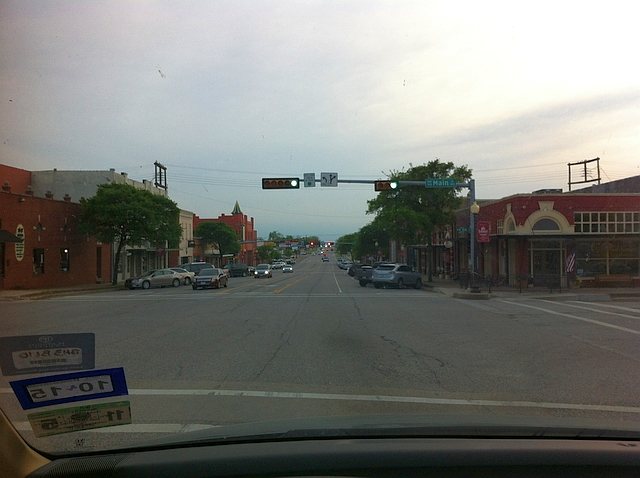
Downtown Ennis also contains an unusally large historic district for a town its size (population 18,711), spanning seven city blocks and containing more than 80 buildings of historic significance, some dating back to the 19th century. You can see a preview of the downtown historic district as you enter on Business 287 in the photo below:
If you’re hungry after traipsing through bluebonnets, there are several restaurants in the downtown area. I’ve never eaten in Ennis, but if you’re viewing the Bluebonnet Trails map, a restaurant directory is available on the Ennis Convention and Visitor’s Bureau website. For what it’s worth, the town boasts 15 Mexican restaurants in total. That’s right – 15 Mexican joints in a town of 18,000. I told you we Texans take our Mexican food seriously.
If you’re the Renaissance Festival type, you can visit the Scarborough Renaissance Festival in Waxahachie, 15 miles northwest via US 287. I find Renaissance festivals amusing personally, but if you’ve never been to one, beware, the people who frequent these things can be a little, um, odd. Nevertheless, a giant turkey leg does kind of hit the spot after walking through fields all morning.


