Ever since I’ve been a little kid, I’ve had a fascination with rivers. It’s a fascination that’s always struck me as a little bit odd, considering I don’t even know how to swim. Maybe it’s because rivers and river valleys usually provide some terrific opportunities for vacation photography. Or perhaps it’s because I’ve pretty much always been a road geek, and rivers are often accompanied by interesting looking bridges, both new and old. Or maybe it’s just because my late father used to love playing in the river that ran through his village in India, and that subconsciously rubbed off on me.
Whatever the reason, I enjoy seeing rivers whenever I’m on vacation. While planning out our road trip to Boston and back to catch our cruise, I wanted to make sure to leave time to see visit the confluence of two of America’s great rivers, the Mississippi and the Ohio, just outside Cairo, Illinois. (I previously toured the confluence of the Mississippi and Missouri Rivers outside St. Louis.) We were scheduled to visit the day before Memorial Day; visiting a river in late spring in the Midwest can be a risky proposition due to the risk of flooding, which may require nearby residents to call on services like the one the link. But this time, we enjoyed a fine day with the river safely below flood stage.
Incidentally, this is also the 16th and final installment of my Bermuda road trip/cruise series. This is something of a bittersweet moment, as on the one hand, it’s nice to have finally finished, but on the other hand, I’m going to have to figure out something else to write about. But I digress. For a primer on our entire trip, head over to my Bermuda trip report introduction and index.
Fort Defiance Park
Directions: From IH-57 northbound, take Exit 12 just past Charleston, Missouri (US 60/62) and head east. Cross the Mississippi River into Illinois, then immediately turn right before the junction with US 51. From IH-57 southbound, take Exit 1 (US 51/State Highway 3) and go south towards Cairo. Pass through Cairo, continue straight (west) at the junction of US 60/62, then turn left immediately into the parking lot. Cairo is located 370 miles south of Chicago via IH-57, 150 miles south of St. Louis via State Highway 3, and 165 miles north of Memphis via IH-55 and IH-57.
Hours: Open dawn-dusk year-round
Entrance fee: None
Facilities: None. There are a couple of picnic tables at the end of the road, but they are practically unusable due to the overgrown weeds. Food, gas, and lodging are available nearby in Charleston, Missouri, 12 miles to the west, and Ullin, Illinois, 18 miles to the north.
Advisory: this is a flood prone area. Check river levels before coming, especially in the spring and early summer. The park is impassible during periods of high water.
Date of Visit – Sunday, May 25, 2014
The river confluence is located in Fort Defiance Park, at the southernmost (and lowest) point of Illinois, and at the “triple point” border of Illinois, Kentucky, and Missouri. At the junction of two major rivers, the site has had strategic significance for many centuries. Archaeological evidence even suggests indications of Native American warfare dating to prehistoric times. More recently, Fort Defiance was an early American military fort, an especially important site during the Civil War. Then, it served as a supply depot and base for General U.S. Grant’s army.
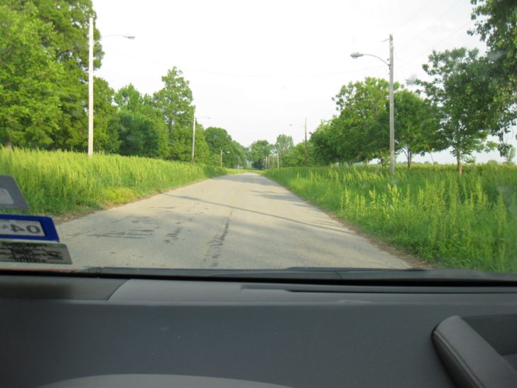
The site was an Illinois state park, but was turned over to the city of Cairo some years ago. Unfortunately, given Cairo’s dire straits, the city probably doesn’t have the money to maintain the park (note: I have seen rumors that the Illinois Department of Natural Resources has recently taken the park back over, but I have been unable to confirm this). There are no facilities remaining, and it is rather overgrown with weeds, which becomes apparent even as you drive down the access road.
Ultimately, though, if you come to a park like this, you come to see nature and the rivers. And by that narrow definition, the park does its job – you can see plenty of both. The access road dead ends at a cul-de-sac about 1/2 mile from the entrance, and from there, a short (few hundred feet) trail leads to the actual river confluence.
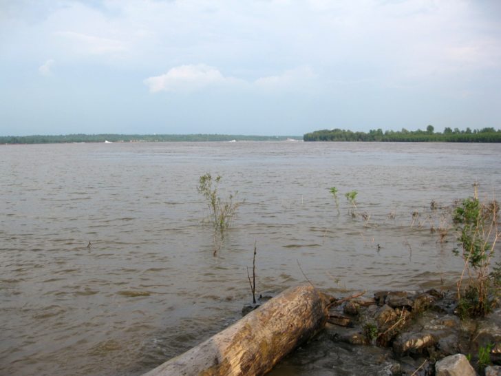
This first photo was taken from the very edge of solid ground at the actual confluence point. The Mississippi River comes in from the right, and continues straight ahead. The Ohio River comes in from the left. At this point, the view straight ahead is along the Mississippi towards Wickliffe, Kentucky.
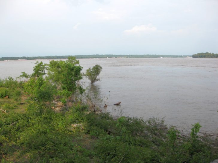
Here, I am standing on the bank of the Mississippi River. You can see more clearly here how the river bends to right, with the Ohio River joining from the left. Kentucky is again in the distance.
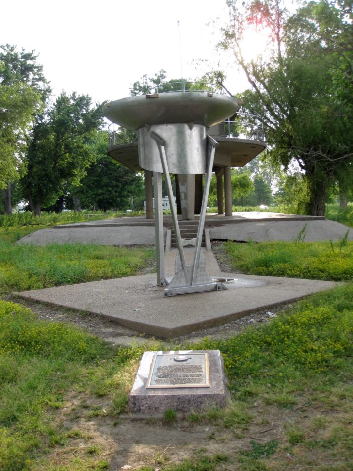
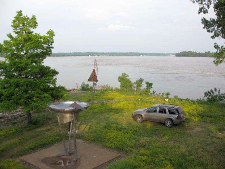
Perhaps unsurprisingly, this site also contains a monument to weather geeks – a ginormous automated rain gauge.
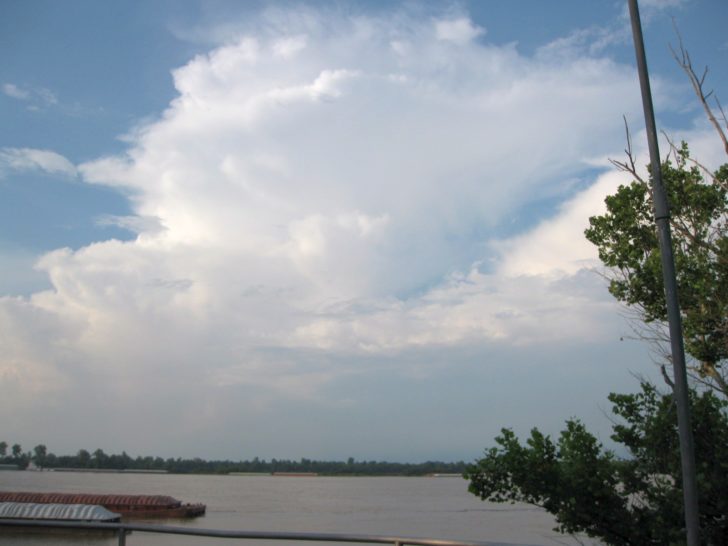
Behind the rain gauge, you can see a small observation tower. The tower looks kind of rickety, but it is safe, and you can climb the stairs to the top for a nice view of both rivers and the confluence point. The first photo is looking directly at the confluence point, and you can see Big Muddy coming in from the right before curving almost straight ahead. There were a few thunderstorms in the distance, and the high point also provided a clear view of a thunderstorm anvil somewhere over Kentucky to the east.
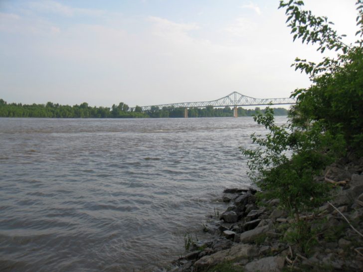
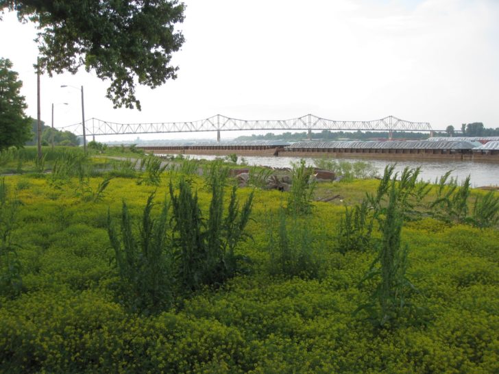
Back on the banks of the Mississippi, this is looking west towards the US 60/62 Mississippi River bridge into Missouri. This is a cantilever bridge built in 1929.
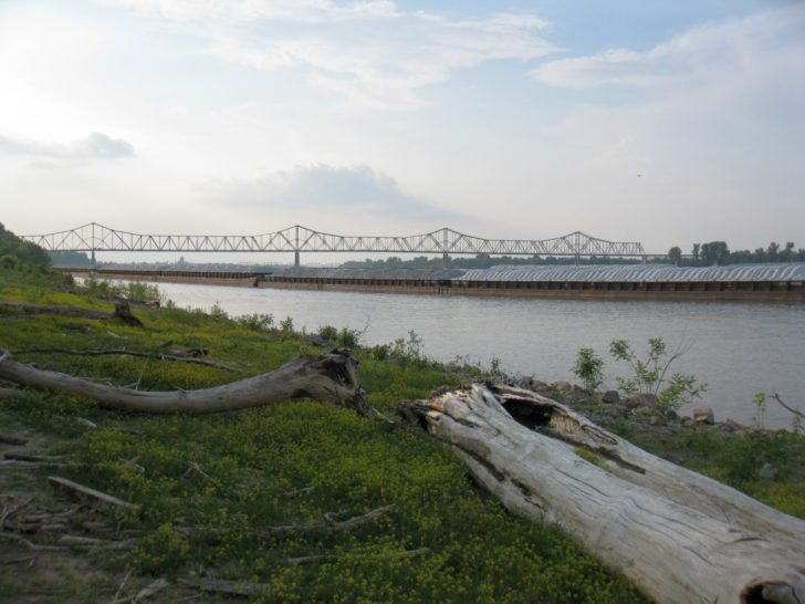
Now, I am standing on the banks of the Ohio river, looking northwest towards the US 60/62 Ohio River bridge into Kentucky. It was constructed in 1937, and carried the Illinois Central Railroad across the Ohio River. At the time, this made it the first railroad linking Chicago and New Orleans. You can also see the barge traffic heading down the Ohio. In the second photo, you can see just how overgrown the weeds are.
If you would like to see more photos of these two bridges, I’ve posted a couple on my review of our drive from Vandalia, Illinois back to Dallas.
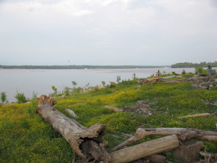
I took one last photo from this location, turned around. Here, you can clearly see the strong current of the Mississippi River as it comes in from the right and then curves forward and then right again. You can also see there’s quite a bit of driftwood here. Given the frequent flooding here, debris is frequently washed into the park. Needless to say, don’t walk barefoot.
That’s pretty much what there is to see here. Is it worth driving the, say, 3 1/2 hours from St. Louis just to see this park? Probably not, but if you’re in the area anyway, then it’s worth a stop, especially for geography geeks. Given the site’s historical significance, the lack of exhibits certainly disappointed. You do get that at the Jones Confluence Point State Park (the site of the Mississippi and Missouri River confluence outside St. Louis), where a marked interpretive trail leads to the river confluence. Perhaps if the state of Illinois really is taking the park over again, they can make some improvements. Some reviews indicate that the park is unsafe; I certainly didn’t feel that way, at least during our daytime visit. There were also a couple of other families visiting at the same time, so I wouldn’t be too concerned about the safety aspect.
Serving Suggestion: Cairo is a stop on the Great River Road, a series of scenic byways that roughly parallel the Mississippi River from the river’s headwaters at Lake Itasca, Minnesota, all the way to the mouth of the Mississippi in Venice, Louisiana, south of New Orleans. I’ve never driven it, but the section of Great River Road northwest to St. Louis, following Illinois State Highway 3, is supposed to be an especially scenic section. Along the way, you can stop at the site of Kaskaskia, Illinois’ first state capital but now a virtual ghost town. Kaskaskia is just across the river from Chester, a little more than halfway to St. Louis, but due to the vagaries of Ol’ Man River, you can only access the townsite from Missouri, off of US 61 between Perryville and Ste. Genevieve, a French Canadian colonial village that is also well worth a visit.


